Jawbone Peak 10K
Maps are HERE. The 10K is the southern of the two loops only.
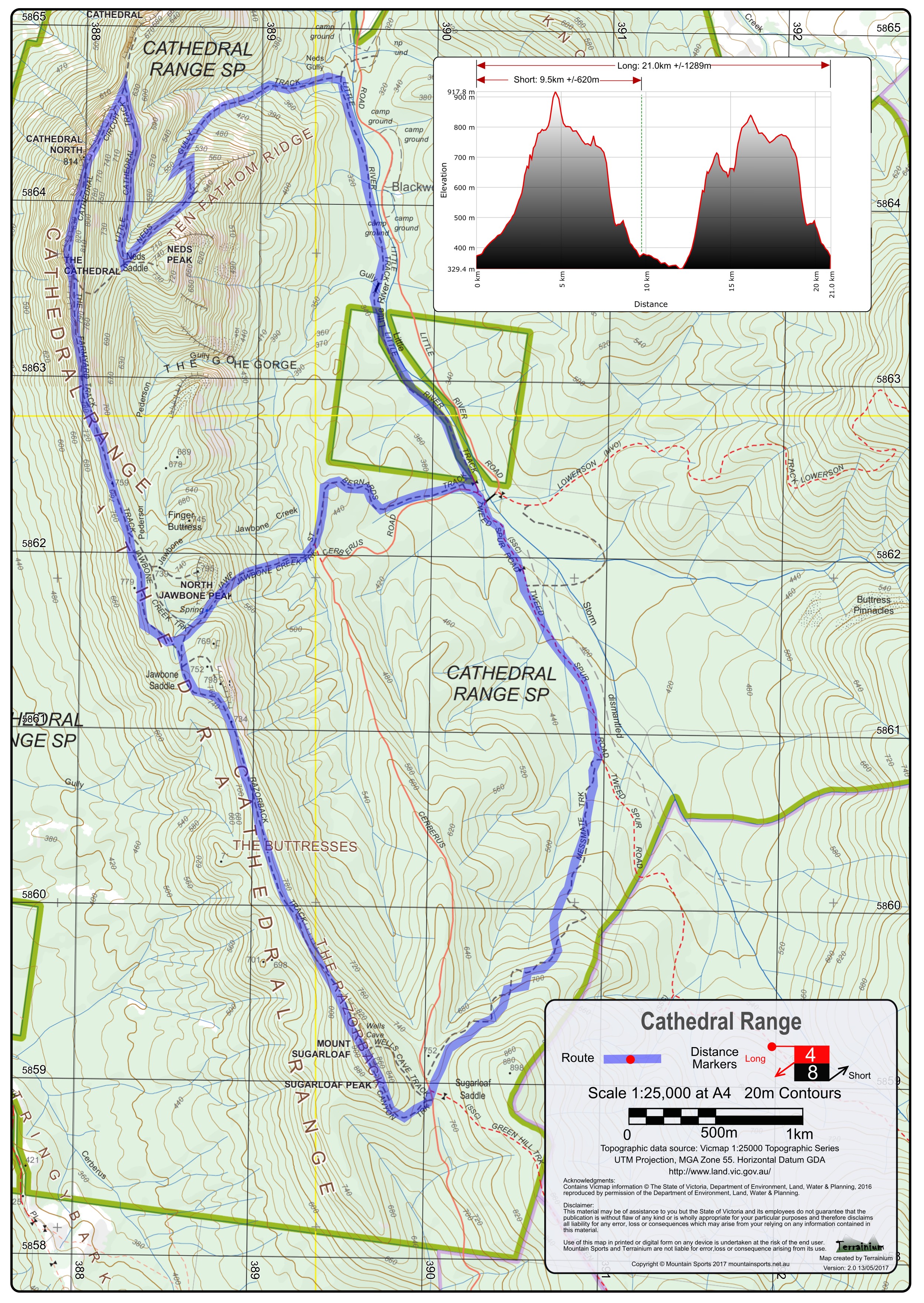
Starting at Cooks Mill Campground, runners head south along the unsealed Tweed Spur Rd for 1.5km before turning right into the Messmate Track and start their ascent through the tall forests emerging at Sugarloaf Saddle picnic ground (approx. 3.5km) and the first aid station.
Runners leave Sugarloaf Saddle picnic ground and are marshalled onto the Canyon Track which transitions from a walking track to impressive faces of Granite and the first true challenge of the run. The more challenging Granite sections will be roped for additional stability and allow runners to continue through at a good pace. Once traversing the granite faces has past – runners will find themselves a short run from the summit of Mt Sugarloaf. Mt Sugarloaf has the highest elevation of the event course and offers tremendous views of what’s to come.
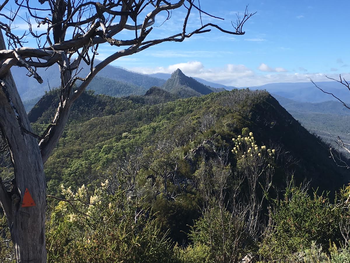
Descending from Mt Sugarloaf runners get a glimpse of the granite fin that runs the length of the Cathedral Ranges and which also is home to the Razorback Track. This part of the course is now technical and runners will relish the challenge as they make their was across the Razorback Track.
Runners pass South Jawbone Peak and arrive at the Farmyard Campground and veer right and start a meandering descent to Jawbone Saddle Aid Station (8km elapsed). From here runners take a more gradual descent through the tall forests along St Bernards Track towards Cooks Mill.
Runners and Walkers in the Razorback Ridge 10k event finish here.
The Razorback Ridge 10k course is in the shape of a loop.